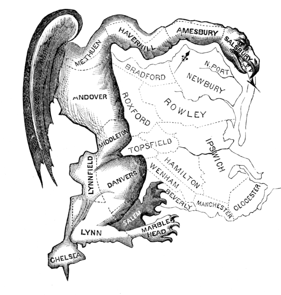
To gerrymander a region is to design the boundaries of electoral districts to benefit one political party. An article on Wikipedia describes the history of the term. An electoral district had such an odd shape it looked like a type of salamander, but was termed a Gerry-mander, after the leader of the political party who stood to benefit, Governor Elbridge Gerry.
Modern gerrymanders
FiveThirtyEight examined gerrymandering in detail, including examples of maps showing how congressional districts in the USA could be gerrymandered to favour either republicans or democrats:
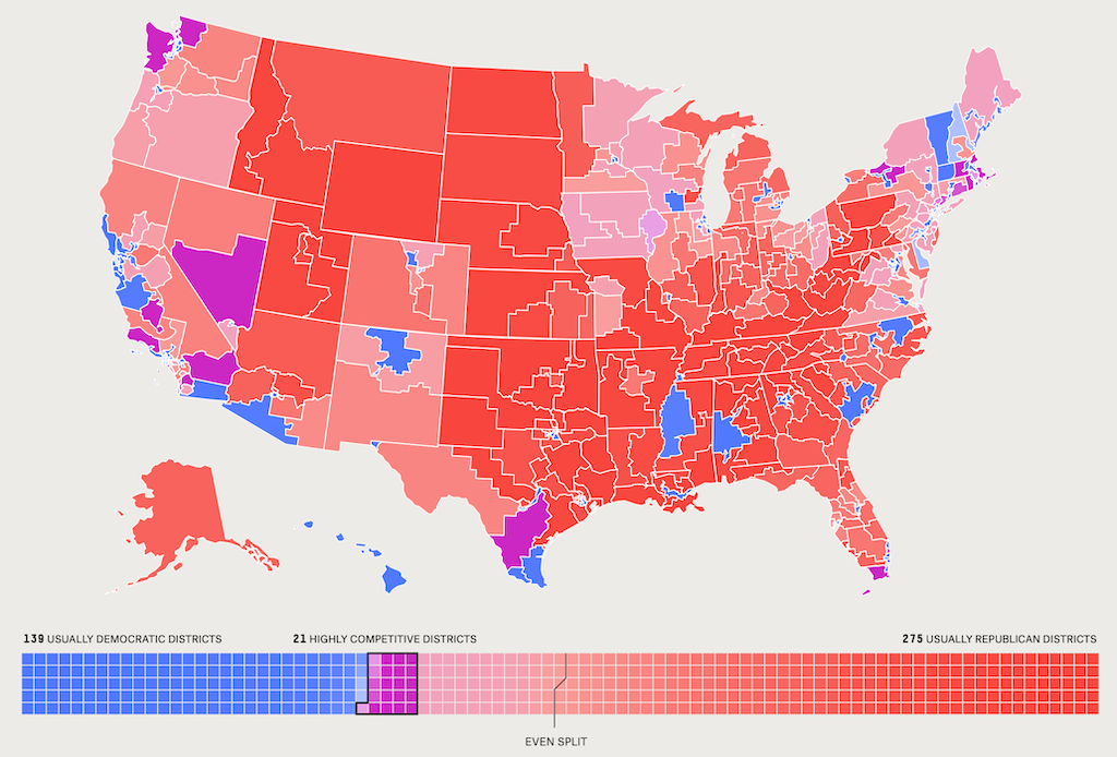
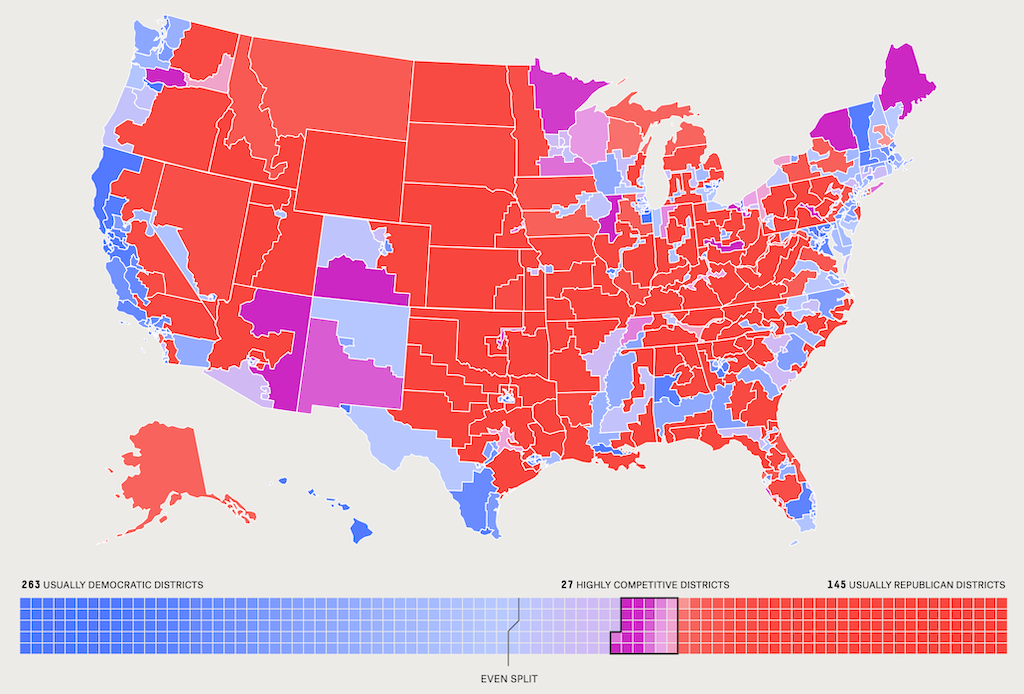
Republican gerrymander vs Democrat gerrymander. Image credits: FiveThirtyEight.
Demonstrating the effect
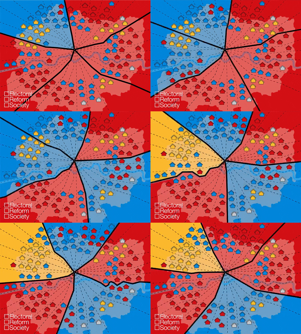
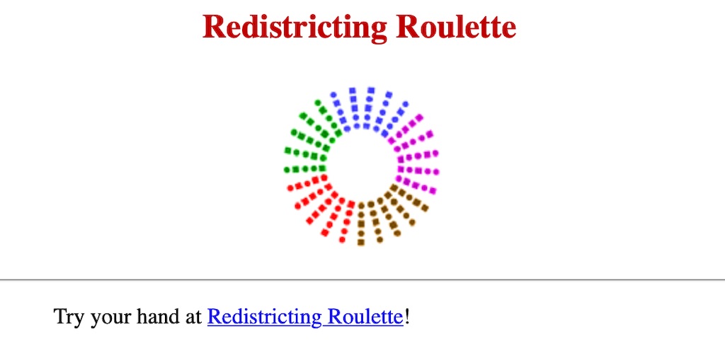
The Proportional Representation Society of Australia developed a “Gerrymander Wheel” to demonstrate how a different electoral boundaries can deliver widely differing results, even if the distribution of voters across a region remains fixed.
Animation of the effect
The Electoral Reform Society in the UK has prepared an animation of the effect. As the “wheel” rotates, and the boundaries are drawn in new places, the results change. The background colour of the segment changes to show which party is elected from that district. As you can see, the results change from:
- Red: 4, Blue: 1, Yellow: 0
- Red: 3, Blue: 2, Yellow: 0
- Red: 2, Blue: 3, Yellow: 0
- Red: 2, Blue: 2, Yellow 1.
Alternative demonstration
FairVote in the USA has published an electronic version of the PRSA’s Gerrymander Wheel.
Preventing gerrymanders
The risk of a gerrymander can be mitigated by requiring district boundaries to be defined by an independent commission; or even better, changing from 1-member districts to multi-member districts.
